Saturday, May 26, 2012

AMBA 2012

Riding next to Mobile Bay

This year, Alabama's Magnificent Bicycling Adventure was based in Fairhope, AL near Mobile. It was a seven day ride, held May 20 to 26. Bob Bender and I drove about 400 miles down to the start, but only rode the first two days of the ride. Sunday's ride was 60 miles to Battleship Memorial Park, and Monday's ride was a century ride to the Naval Aviation Museum in Pensacola, FL. where the Blue Angels are based.

Bob Bender

Bob and I both felt that many of the roads we were cycling on were a bit dangerous because of the heavy and fast traffic. This was true particularly on Monday, when we rode a good deal on US98, FL292, and the Foley Expressway (a toll expressway).  Accordingly, we decided not to continue with the remainder of the ride for safety reasons, and we drove home on Tuesday.

Saturday, May 12, 2012

BRP - Final Day - MP 431.4 to terminus at 469.1

Final group start

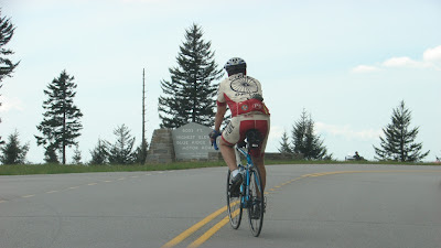
Today, we completed our ride of the BRP. It was an easy day of 38 miles with 7,500 feet of descent and “only” 3,500 feet of ascent. The descents of 12 and 10 miles each seemed to go on forever. The weather was overcast, meaning we were in the clouds at elevation. It was cold coming down the mountains though we warmed up on the climbs.

We were in the clouds before descending
Finally we reached mile 469, took some pictures, changed clothes at the nearby Visitors Center, and said our final good byes. Then, Karen and I had a 125 mile, three hour drive home.

The finish


Final Mile marker
 
Thanks to my wife Karen for joining and supporting me during the trip and for driving our car while I was cycling. Thanks to Jeff Douglas and Mark Koltz for putting up with me for 8 days. I hope I’ll be a good roommate in September when we ride down the Pacific Coast.  Also, thank you to Aila Douglas for supporting the three of us this week and for keeping Karen company while we were riding. Karen enjoyed the time spent with you, Aila.

Thank you, Jeff

Thank you, Mark

A few random thoughts about cycling the Blue Ridge Parkway follow. Just in case you are reading this and are considering your own ride. These notes are not in any particular order:

1.     The BRP is 470 miles long and you will climb 49,000 feet, excluding the side trip up Mount Mitchell. We cycled 452 miles and climbed about 47,500 feet (one section of parkway was closed for construction).  The ride wasn’t easy, but climbing in the North Georgia Mountains a couple of times a week for the last four months at 100 feet of climb per mile really helped prepare me. My endurance was fine, having done a lot of long, slow, and steady training climbs. Again, thanks to everyone who rides with me at Burnt Mountain and The Gaps.

2.     The parkway grades weren’t difficult.  The length and frequency of the climbs is what made the ride hard.  Most climbs were 6% to 8% grade. Rarely did my Garmin hit 9% and I can’t recall a single climb that hit 10%. But the climbs were long and unending. Climbing to Apple Orchard Mountain was 13.7 miles and 3,300 feet. The climb to Waterrock Knob was 8.1 miles and 2,450 feet. Both ends of the parkway were more difficult than the middle section.

3.     There are virtually no flat sections on the parkway. You won’t be doing any drafting and likely will be regrouping with your friends at parking outlooks or at the top of the climbs.

4.     Stay at the two hotels on the parkway if you can. They are Peaks of Otter at mile 86 and the Pisgah Inn at mile 409. The rooms are nice, the views from each room spectacular, prices reasonable, and the hotel restaurants pretty good. There are no phones, television, or internet connections at the former and the internet connection at the latter is somewhat spotty.

5.      If you do your research, there are other hotels not directly on the parkway but within a quarter mile on private property. We passed several that looked nice and we stayed at the Woodberry Inn at mile 174 which was very pleasant. The Boone/Blowing Rock area was a good place to get off the parkway and take a break.

6.      Cell phone coverage is spotty on the parkway. Especially if you have AT&T.

7.     You really need to have front and back lights on your bicycle. Back lights so cars and motorcycles can see you in bad weather and in tunnels. And a strong front light for the tunnels, especially the ones over 500 feet long. My front light was too dim and at mile 399 I encountered the 1,434 foot Pine Mountain Tunnel. That’s over a quarter of a mile long. And I didn’t know the tunnel curved. After a couple of hundred feet, I couldn’t see a thing. It was pitch black in the middle of the tunnel. Try riding your bike at 20mph in the complete dark and tell me how it went for you. I was lucky I didn’t hit a tunnel wall or an oncoming car. By the time I saw daylight and got reoriented, I was in the oncoming lane about 8 feet from the left side wall. In another tunnel, I had six cars and two motorcycles pass me and I was a little wobbly when they went by.

8.     Keep two hands on the handlebars at all time. The parkway roads are not as good as the ones in North Georgia or on the Natchez Trace Parkway. There are potholes, cracks, and bumps all over the place. The thing I hated most were the small circular depressions that were maybe six to twelve inches in diameter and an inch deep and that you couldn’t see until you hit them with your front wheel. No problem if your hands were on the handlebars, but a moment’s inattention could have spelled trouble. I kept thinking of Jens Voigt in the 2009 Tour de France. Today while riding the first downhill at about 30mph, a deer ran across the road about 10 feet in front of me, but that’s another story…

9.     Regarding Mount Mitchell. You must climb it at mile 355 because the views from the observation tower at the top are spectacular. The Mount Mitchell road is 4.8 miles long from the junction with the Blue Ridge Parkway to the summit. The first mile starts at 5% and quickly jumps to 8%. Miles two and three are a steady 8%.  Mile four drops to between 0% and 5% before the final mile at 8% to 9%.

10. Be flexible. Allow at least one contingency day for rain if you can.  The mountain and valley views are spectacular the entire 470 miles, but if it is raining you will not see anything and be miserable. Expect rain; you will be over 4000 feet a good deal in North Carolina. If you can be flexible on the daily mileage, ride more miles on good days and back off if the weather is bad. That worked out well for us. Though we rode in the rain, our rest day was when the weather was at its worst. I thought the views were the best at the higher elevations in North Carolina, and we were lucky to have our best weather on those days.

11. There was more traffic than I thought. Especially in the Roanoke and Asheville areas. And there were a lot of motorcycles, similar to riding at the North Georgia gaps on weekends. Most drivers were courteous but someone threw a full can of soda at Jeff in the Asheville area, and a couple of oblivious elderly drivers came a little too close for comfort. (I know they were oblivious and elderly because they were stopped at the next parking outlook.)

12. Our ride was in early May. At the very start and end of the ride at 2000 foot elevation, summer gear was fine. During the ride I had to wear arm and leg warmers, a vest, and either a windbreaker or raincoat every day. Bring rain gear and be prepared for any type of weather. A cheap hotel shower cap over your helmet might look funny but it will keep your head warm and dry. Take a lot of Ziploc bags for your phone, maps, and cue sheets. Bring lots of bars and gels; you will eat all of them. If you don’t have SAG support, there are some stretches of parkway without water. So do your research and/or refer to the book and links mentioned below.

13. The book Bicycling the Blue Ridge by Elizabeth and Charlie Skinner (©2004) has elevation charts, the distance and length of all significant climbs, and mile by mile guides of most everything you need to know about the Blue Ridge Parkway and Skyline Drive. The links below will also help plan your tour:

a.      Blue Ridge Parkway Association: http://www.blueridgeparkway.org/
b.     National Park Service Site: http://www.nps.gov/blri/index.htm  (Check for any section closures.)
c.       A mile by mile parkway guide: http://www.ncnatural.com/Parkway/MilebyMile.html


Next up is Alabama’s Magnificent Bicycling Adventure (AMBA) in a week’s time.

Friday, May 11, 2012

BRP - Day 7 - MP 376.7 to 431.4

 Jeff sets the pace on a beautiful day

Today's ride was only 55 miles but we climbed over 7,000 feet, making it a difficult day after the 10,600 feet we climbed yesterday. The weather was again perfect and our route took us up to 6053 ft. in altitude, the highest elevation directly on the parkway.

Jeff and Joe at mile 428

 Joe at the end of today's last climb
 Joe, Jeff, and Mark at the end of the day's ride

We are staying at the Pisgah Inn at mile 408.6. Originally we planned on riding only to this point, but we cycled an additional 23 miles to shorten the final ride to mile 469 at the end of the parkway. This will allow Jeff, Aila, and Mark to get a jump on their ride back home tomorrow afternoon. The Pisgah Inn is very nice. Each room has a wonderful view of the mountains. Aila and Karen had a nice lunch in the restaurant and everyone also enjoyed dinner and dessert here tonight.

The Pisgah Inn at MP 408, right on the parkway

So far, we've cycled 414 miles and climbed 43,900 feet in six riding days. It has been a difficult week but Jeff and I each felt pretty good after today's ride. I am going to have to tackle the Brasstown Bald climb when I get home. Thanks to everyone I've ridden with at Burnt Mountain and at the gaps.  Those hilly north Georgia rides have really helped to prepare for this ride.


Today's Garmin stats:  http://connect.garmin.com/activity/177147758

Thursday, May 10, 2012

BRP - Day 6 - MP 293.8 to 376.7

 Hallelujah, a nice day

Yesterday, we took a planned day off in Boone and Blowing Rock. Which was a good thing because it rained most of the day. Sightseeing, shopping, and eating some good meals was a nice change after four days of hard climbing.

Today, the weather was beautiful. Mid 40's and cloudy at the start, later reaching the low 70's with sunny skies.


 Mark, Joe, and Jeff are optimistic about a long day ahead.

Today, the plan was to ride 84 miles on the BRP, plus a ten mile out and back 1400 foot climb of Mount Mitchell. We had a great day, finishing with 94 miles cycled and over 10,000 feet of climb. The parkway at elevation was beautiful. We spent a good part of the day at over 5000 feet of elevation.

 Great views of the Blue Ridge early in the day


 The Linn Cove Viaduct

 Mount Mitchell. (Summit towards the right.)

This is the view of Mount Mitchell from the parkway about 5 miles before the side road leading to the summit. The 4.8 mile climb on the side road starts with 3 miles at 8% incline, then an easy mile at 0 to 5%, followed by a final mile at 8 to 9%.


 On top, near the observatory tower


 Jeff and Mark on the last climb of the day


 At Craggy Gardens, before the final descent


Thanks to Karen and Aila for supporting us and driving the cars.

Here are the Garmin stats for the day:  http://connect.garmin.com/activity/176878177

Tuesday, May 8, 2012

BRP - Day 4 - MP 247.9 to 293.8


A tough day to cycle the BRP. It was pouring rain when we arrived at the other side of the closed section of parkway. I was ready to ride. Mark was at least smiling. Jeff didn't seem too happy to start. Never the less, we cycled south towards the Blowing Rock/Boone area to stay on schedule.


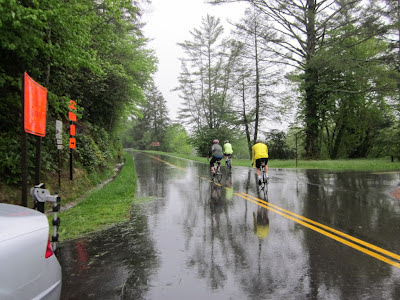
It rained steadily for the first 28 miles. At times it was a drizzle and at times it was a downpour. But it never stopped. At home, one would just cancel their ride. But when you are on the road and on a schedule, you don't have as many options.


There were no views early on. Did I mention that it rained a lot? But between my raincoat and the shower cap over my helmet, I stayed pretty warm as long as I didn't stop.


Finally, it stopped raining for the last hour and a half of the ride. The sun briefly came out and there actually were some views of the mountains and valleys.  We are hoping for better weather as we get into higher elevation the further south we cycle. For a short day, there was a lot of climbing. No large climbs, just a lot of small 200 foot ups and downs that added up to over 100 feet per mile of climb.

Tomorrow is an off day in the Blowing Rock/Boone area. I'm not sure what we will do, and likely will leave it up to Aila and Karen to decide.

Here is today's Garmin data:      http://connect.garmin.com/activity/176212729

Monday, May 7, 2012

BRP - Day 3 - MP 162.4 to 217.5


Today's ride was only 55+ miles and 4993 feet of climbing. After breakfast, we cycled 14 miles to Mabry Mill at mile post 176 and stopped for the obligatory photo in front of the mill. This is the most photographed spot on the BRP. Arm warmers and vests or windbreakers were required today.


We started with overcast skies which became fog when we climbed to higher elevation. These two pictures are at 3000 feet elevation. We'll be at 6000 feet in a few days. The sun did come out in the afternoon.


For most of today's ride we had rolling terrain.  A few hundred feet of uphill and a few hundred feet of downhill. No large climbs like we had on Day 1 and 2, or like we will have later on in the week. In all, an easier day after a lot of climbing the previous two days.


It was good to see mile post 200. We are making progress.


The Virginia/North Carolina state line was reached at mile 216.9.


Here, I reach Cumberland Knob with Mark at mile 217.5. At this point the road is closed for the next 20 miles due to construction on the rock retaining walls. There is an hour detour by car to reach the other end of the closed section. Accordingly, this was a good place to call it a day, and we are staying at a hotel in Sparta along the detour. Conveniently, this was also a good place to stop in order to visit my mom in Fries, VA this evening.


Another nice day for a ride. Hopefully we will have clearer skies when we get to the higher elevations the next few days.

I can't seem to download my Garmin data for today's ride. So here is a link to Jeff's data:
http://connect.garmin.com/activity/175885539


Sunday, May 6, 2012

BRP - Day 2 - MP 85.6 to 162.4


Another great day on the Blue Ridge Parkway. After a great buffet breakfast at the Peaks of Otter lodge, Jeff, Mark and I headed south. Today's ride was 77 miles and almost 7000 feet of climb. The weather was much better today. A bit hazy in the morning but clear skies the rest of the day. These pictures are typical views on the parkway today.


There are virtually no flat sections on the parkway. You are either cycling uphill or downhill. The surface of the road is generally good, but there are potholes, dips and small sunken holes maybe three inches across to deal with. So a cyclist needs to pay attention to the road and keep a strong grip on the handle bars at all times.  The road surface is not as good at the north Georgia roads or the Natchez Trace Parkway (NTP). I guess this can't be helped with the snow and ice they have up here during the winter.


There are many overlooks and other stopping places along the way. Water and bathrooms are not as convenient as those on the NTP. In fact there was no water available during today's ride. Also may of the visitors centers are not open yet. We are fairly early for a BRP ride. We saw several local cyclists from Roanoke today, but we haven't seen any end to end riders as yet.


Aila and Karen met us with the cars at milepost 162.4 and we are staying at the Woodberry Inn in Floyd, just a stones throw from the parkway.

Here is today's Garmin data:   http://connect.garmin.com/activity/175549169

Saturday, May 5, 2012

BRP - Day 1 - MP 0.0 to 85.6


Karen and I met Mark, Jeff and Aila at the hotel in Waynesboro last night and after a good nights sleep, we drove to milepost 0.0 to begin our Blue Ridge Parkway ride. The weather was mostly overcast at the start.


Today's ride was 86 miles to the Peaks of Otter lodge, one of two hotels right on the parkway. The total parkway mileage is 470 with 48,600 feet of climb, excluding a side trip up Mount Mitchell. We had great views early in the day. The Parkway runs right along the top of the ridge with good views to the valley both to the east and west.

This is Mark during the beginning of today's big climb.  From mile mark 63.0 to 76.7 is a 3305 ft. climb.


The weather deteriorated as we reached elevation. Basically, it poured. But we finished today's ride safely and had a nice dinner and evening at the Peaks of Otter lodge.

Today's Garmin data (the climb was over 8000 feet but the weather caused my Garmin to miss one of the climbs.):  http://connect.garmin.com/activity/175549217